Pinta Verda Plan

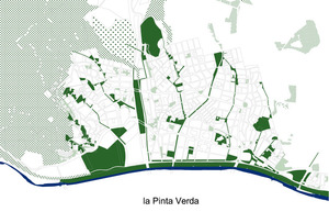
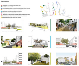
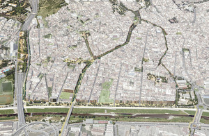
The project involves a new structural model (the Green Comb) to rearrange the town based on free space, linking all the neighbourhoods and connecting the Besòs River with the Marina mountain range. This model will be implemented by modifying planning and redeveloping squares and streets.
- Area:
- 235.633 m²
- Phases:
- Estudi -
- Supervision and coordination:
-
Josep Maria Carreras (Director of Urban Planning Services - AMB)
- Drafting team:
-
Isabel Tomé and Jordi Peralta (architects - AMB), Judith Recio, Santi Pérez, Helena Valls, Gavina Corbetta (architecture students - AMB)
- Municipalities:
- Santa Coloma de Gramenet
- Legal support:
- Laia Soriano-Montagut (lawyer - AMB)
Gallery
Description
Urban planning and legal analysis of the green areas in the municipality of Santa Coloma de Gramenet. Criteria for action for plots of land subject to expropriation by operation of law
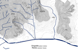
This study of the analysis, diagnosis and management of the green areas still to be created is part of one of the pilot studies carried out in four municipalities in the metropolitan area, in order to summarise a method for resolution that can be extrapolated to the rest of the territory. It is therefore subject to the general framework document at the urban planning and legal level as regards privately owned land subject to expropriation. The objective is to enable the functional improvement of public green areas, based on diagnostic factors and proposed criteria that can re-establish the allocations of land in the various neighbourhoods, enhancing the underlying urban structure. This quantitative and qualitative improvement will permit Santa Coloma de Gramanet to efficiently manage its efforts to remedy its historical shortcomings. The town of Santa Coloma is located between the Marina mountain range and the River Besòs, and is often laid out in streets that follow the course of the former streams. The proposal is to take advantage of this structure and make it the basis of the Pinta Verda project. The background that has contributed to the current situation of open spaces in Santa Coloma is as follows:
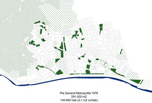
- In 1976, the General Metropolitan Plan classified 291,000 m2 of the municipality as a green area. It was necessary to halt the speculation that was taking hold of the entire town of Santa Coloma.
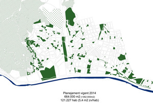
- As a result of the initial impetus provided by the People’s Plan and the work done by 40 years of democratic municipal councils, planning has increased the number of green areas, and as such the planned area now amounts to 664,000 m².
- More than 100,000 m² of the river park area (which cannot be classified as a green area from an urban planning perspective because it is classified as water) have also been restored to public use.
- These increases are the result of many different projects, and have led to a number of dysfunctions which now need to be corrected.
In December 2014, an amendment of the Metropolitan General Plan was presented to Santa Coloma de Gramanet Municipal Council in this regard. The amendment brings order to the urban planning situation of many areas of land in the municipality, and proposes strategies including:
- Releasing properties from attachment. A total of 85 properties where around 130 families live, located in areas that are not considered strategic within the Pinta Verda model, are entirely released from attachment.
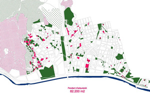
- Areas for action. Some 32,000 m2 of green area will be transferred from private to public ownership, through transfers obtained by defining 16 areas for action. A total of 80 social housing units and 140 free housing units can be built in these areas.
- Realistic classification. The classification of publicly owned areas is brought into line with the real situation on the ground. This recognises 27,000 m2 of actual or planned green space that was not taken into account in the urban planning.
The Pinta Verda becomes a plan for the future that guides the approach to the urban development of the streets that, due to their location, act as the main links in Santa Coloma’s network of open spaces and facilities.
This document contains preliminary studies. The modified General Metropolitan Plan subsequently drafted by the Municipal Council was provisionally approved on 7 April 2015.


