Cornellà Natura

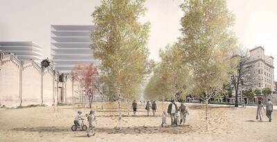
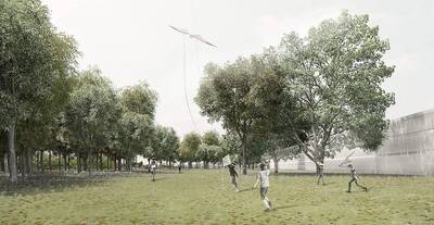
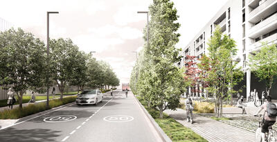
The objective of the Cornellà Natura model is to bring the city closer to nature, emphasising its environmental, social and landscape values, thereby making it more human.
- Area:
- Municipal level
- Phases:
- Estudi -
- Supervision and coordination:
-
Àrea de Desenvolupament de Polítiques Urbanístiques: Josep Maria Carreras i Loles Herrero.
Direcció de Serveis de l'Espai Públic: Noemí Martínez.
- Drafting team:
-
PROCORNELLÀ: Ricard Casademont.
DATAAE: Claudi Aguiló Aran, Albert Domingo.
- Municipalities:
- Cornellà de Llobregat
Gallery
Description
A sustainable urban structure requires planning that conserves areas of vegetation or agricultural land around built-up urban centres, allowing the wealth of these spaces to become part of the character of the city and the domestic life of its inhabitants.
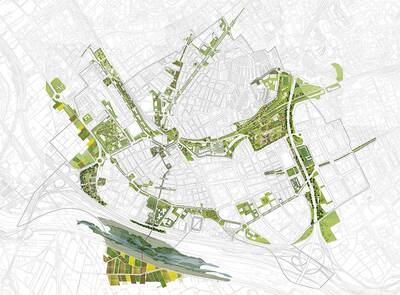
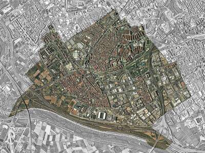
With a view to introducing natural areas, the Cornellà Natura model identifies green spaces and natural features in the municipality and its environs, the structure of squares and main roads, facilities, heritage buildings, and also the public transport and active mobility network.
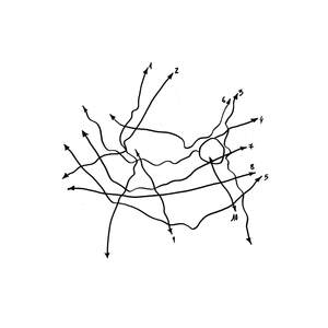
From this starting point, the model organises the city along five axes that connect neighbourhoods with the natural spaces around them. These axes provide a spatial structure for social interaction, leisure and the promotion of nature and biodiversity. The model uses existing urban spaces along each of the five routes, defining strategic areas of action to ensure ecological and social continuity and connectivity.
Axis
- Axis 1: from the Pedró neigbourhood to the Llobregat River Park. This axis crosses the municipality from north to south, linking up with the neighbouring municipality of Sant Joan Despí. It builds on and completes the connection between the agricultural land of the Baix Llobregat Agricultural Park and the open spaces in the municipality. It includes the area round the Siemens plant, which is to be redeveloped. It will link up with L’Església Square, and Mossèn Jacint Verdaguer and Verge de Montserrat streets, which will also be remodelled.
- Axis 2: from Esplugues Road to the open spaces at Salines. This axis crosses the municipality from northeast to southwest. It connects with Esplugues de Llobregat and includes the area round the Can Bagaria industrial site, which is due to be redeveloped, L’Estació Square, which plays a key role as an interchange between the main public transport networks, and Les Aigües Park.
- Axis 3: from the Sant Ildefons district to L’Hospitalet Sud. This axis crosses the municipality from north to south and connects the open spaces located around the Ronda de Dalt. To the north it extends towards L'Hospitalet de Llobregat; to the south, it connects Can Mercader Park, Joan Miró Square, the Almeda football ground, Martinet School and the future Rondes Park which will border the open spaces planned in L'Hospitalet de Llobregat.
- Axis 4: from Can Fatjó to the Can Mercader metropolitan park. This axis crosses the municipality from east to west around the railway line and extends towards the neighbouring municipalities of Sant Joan Despí and L'Hospitalet de Llobregat. It connects the Can Mercader and Canal de la Infanta metropolitan parks, crossing L’Església Square and the redeveloped green area of Alps Avenue.
- Axis 5: from the Baix Llobregat Agricultural Park to L'Hospitalet de Llobregat. This axis crosses the municipality from west to east and ensures the continuity of the open spaces located around Sant Joan Despí Road and El Carrilet Avenue in L'Hospitalet de Llobregat, while running through Cornellà's urban parks. This axis includes Baix Llobregat Avenue, the Tintes Especiales sector, which is to be redeveloped, the improved Pas de la Ribera, Progrés Street and Maresme Avenue, which is also due to be redeveloped.
The Cornellà Natura model is the starting point of a strategic project developed by Cornellà de Llobregat Town Council to make the city greener, more biodiverse, resilient and sustainable over a 10-year period (2016-2026). The five green axes form the basis for a range of measures and policies aimed at improving and ensuring the quality of the environment, increasing biodiversity and implementing more user-friendly transport options.


